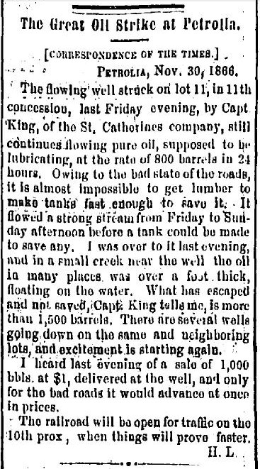
Most Petrolians know about the famous King Well. It’s long been part of Petrolia’s founding mythology. Popularly regarded as the strike that kicked off Petrolia’s 40 year reign as “Oil Capital of Canada“, the truth is actually a bit more nuanced. But, that part of the story will have to wait for a future post…
Many people have guessed and many think they know where the well was located. But, it wasn’t until I made a serendipitous find at the Lambton County Archives in 2010 that my comprehensive investigation into the well, the man who drilled it and it’s precise location was begun.
The complete narrative of that quest has yet to be completed. But over the past several weeks, culminating in a field trip yesterday, another chapter can now be written, at least in part.
The Search for King’s Flowing Well
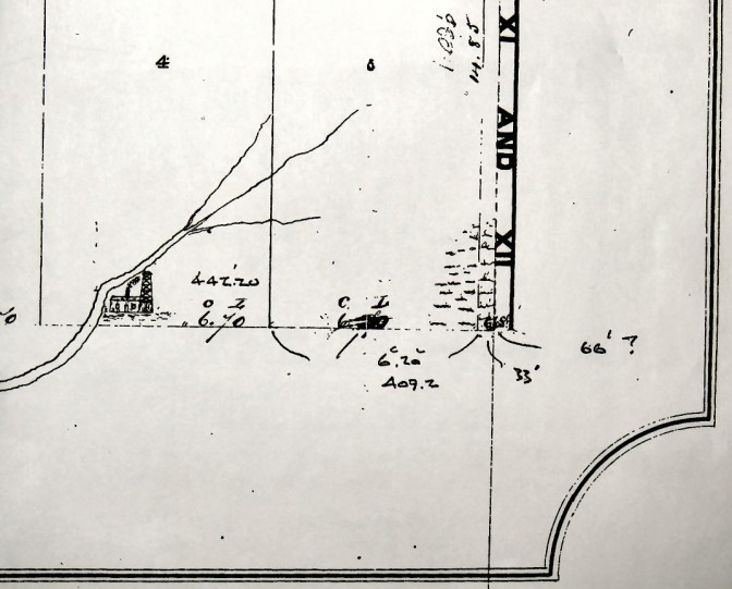
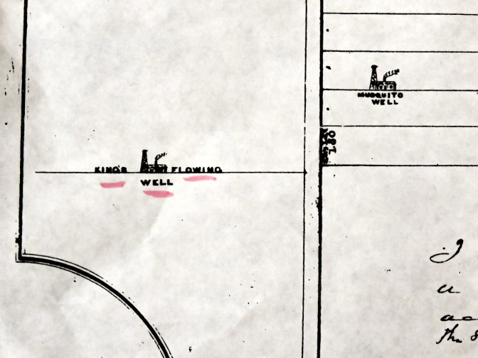
Years of research, beginning about 2010, had located three contemporary surveys, showing the approximate location of the well. In two of these, the well was indicated by hand drawn derrick icons. But, none of these provided precise measurements to what today would be a mere piece of rusty metal well casing; most likely buried.
So, after spending dozens of hours pouring through and analyzing scores of 150 year old deeds at the Lambton County Archives and on microfilm at the registry office (with the help of the indefatigable David Hext), no conclusive evidence – ideally, in the form of an actual mention of the well – had been found. There are still many, many more deeds yet to examine, so the “smoking gun” reference to the well may still be waiting to be discovered.
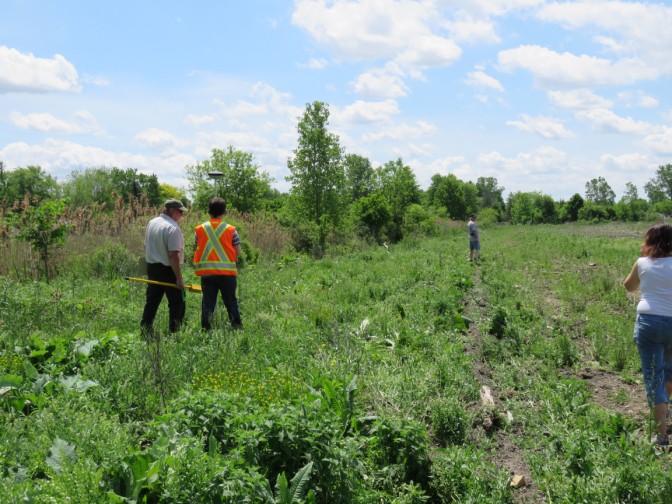
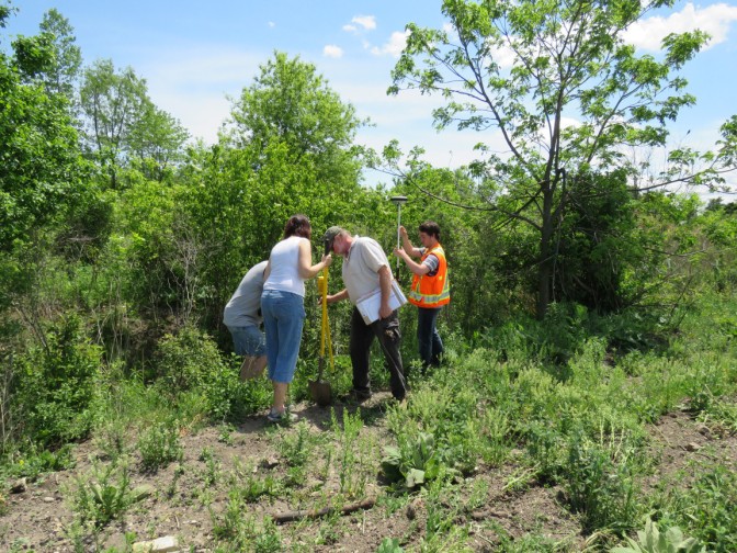
However, the deed search did – along with the surveys – allow us to narrow down the location of the well to within about a one or two acre area. So, armed with a metal detector, a survey grade GPS (courtesy of Jim Gould and a technician from Monteith and Sutherland) and permission from the land owner (a relative of Heidi McNabb of the Petrolia Heritage Committee), we set off to find “King’s Flowing Well“.
I was under no illusions about the odds of conclusively identifying the actual well. The “King Well Territory“, as it was referred to by oil men and contemporary newspapers, for decades after the well was struck, had a few wells being sunk on it even as the well was being drilled.
After the well struck oil, at the rate of 800 barrels a day on November 23, 1866, literally dozens of wells were subsequently dug as close to it as possible. So, even if we managed to locate a well casing, determining whether it was the actual King Well was going to require diving back into the deeds, in hopes of finding more corroborative evidence.
The magnitude of the task soon became apparent. The land where the King well was located has been reworked countless times over the decades. It is greatly disturbed and hummocky and has only recently been once again plowed over.
It is also strewn with metallic debris – which interferes with the metal detector – such as countless bits of the the small diameter piping that transferred oil from the well heads to the larger underground storage tanks. This metal detritus makes finding anything more significant very difficult.
The beaming hot sun and insects didn’t help much, either.
We spent about two hours in the field and while we didn’t manage to expose any well casings, we did get indications of a few potential candidates, buried a few feet underground.
Because we were instructed not to do any deep digging (and the ground was far too difficult to dig deeply into, in any case), we recorded the GPS coordinates of these metal detector “hits” for future reference. Hopefully, the property records might eventually narrow down these potential targets. Digging them up wouldn’t have helped identify the specific well, anyway.
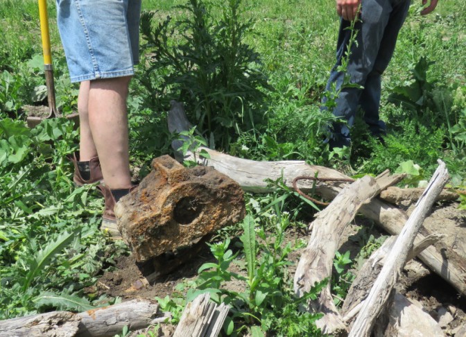
But, despite not finding any actual wells, it quickly became obvious that we were in the right area. Our sweat and bug bites were rewarded with several finds of oil well artifacts.
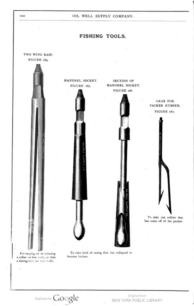
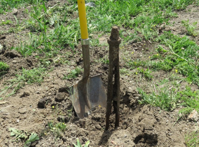
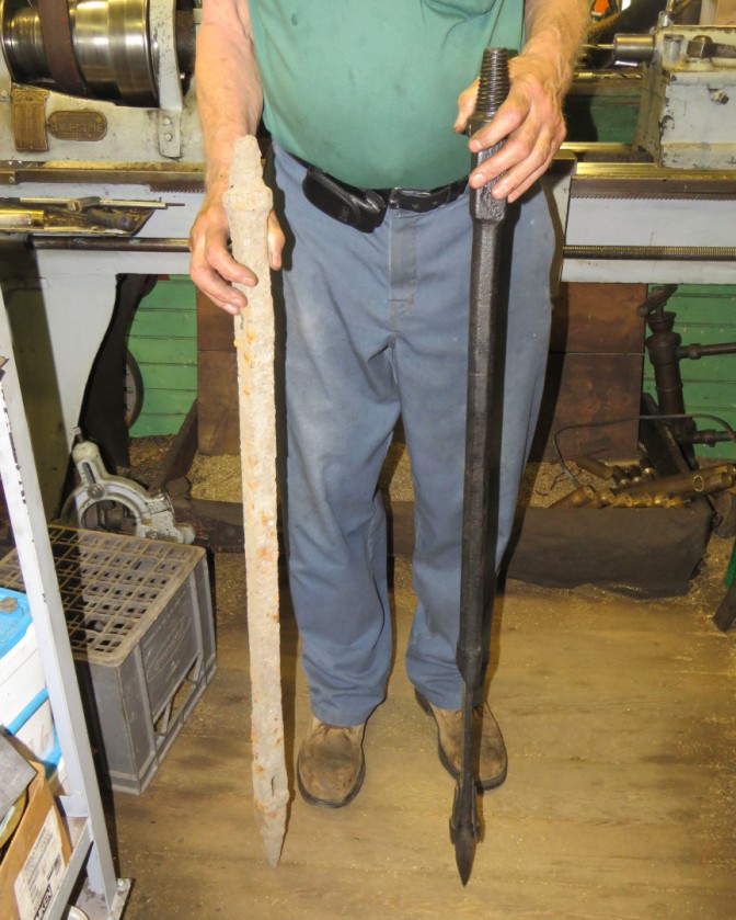
The most exciting of these was an oil well “fishing” tool, which was used to retrieve drilling tools that became lost, or stuck, in the well, far underground. These fishing tools came in a huge array of shapes and forms, all designed to do a specific job.
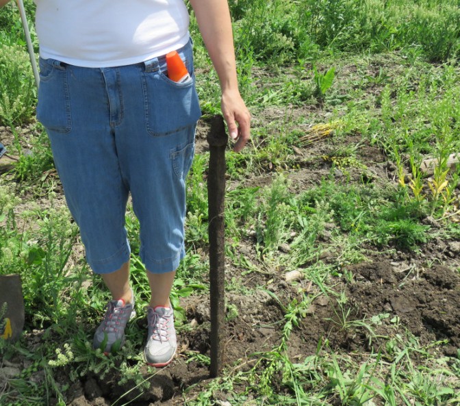
- Our first artifact! An oil well fishing tool…
Another find was a drill rod end connection joint. This was attached to each end of the 40 foot long wooden drill rods, made of Lambton’s famous Black Ash, which was strong, straight and durable. These rods were connected together in long “strings” to drill deep into the earth.
In addition, we found small beds of cinder laden ground, which would indicate the location of a steam engine. This would have powered the oil derrick during drilling, or pumping the well. Or, perhaps, it would have powered the central jerker rod pumping system that would have pumped multiple wells in the field.
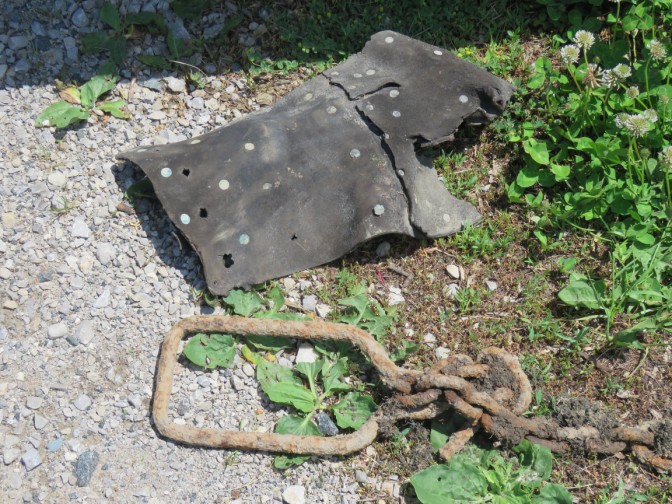
Near one of these beds of cinder, pieces of drive belting and a large bearing block, used to support the shaft of a drive wheel was found, further confirming that this was the location of an engine house.
Finally, a walking beam yoke, which attached to the oil well pump rod to pump the well was found.
I had recognized the fishing tool and some of the other finds from my work researching Canadian drilling rigs. But, we decided to take all of them to the closest expert at hand, which was Albert Baines, at his wonderful museum of a machine shop.
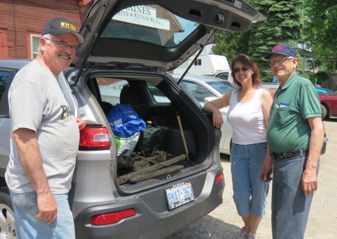
Not only was Albert able to identify them, he actually had a similar style fishing tool among his many antique oil field relics. I think it’s safe to say that Albert was pleased we dropped by.
While the exact location of the King Well remains a mystery for the time being. We now have the GPS coordinates of several potential well sites and a few fascinating artifacts to display.
All in all, it was a productive and satisfying day of exploration and future research may yet locate the oil well that put Petrolia on the map.
Steve Loxton
May 2016
[Special thanks go out to Jim Gould, Monteith and Sutherland and to the property owner for allowing us to search.]

Enjoying the sequence of events
LikeLike